The warm phase of the El Nino is predicted to intensify to a moderate or strong level this fall. Forecasters expect a 63% chance sea surface temperatures in the Nino-monitored region of the Pacific will exceed 2 degrees Celsius.
El Nino, a natural climate event, is declared when surface sea water temperatures in the central and eastern tropical Pacific Ocean are 0.5 degrees Celsius warmer than average for several consecutive months, triggering a shift in trade winds. It typically lasts nine to 12 months and is a major driver of global weather.
“The weekly numbers, they’re past 0.5. In fact, it went up another 0.2 this week, and the winds at 5,000 feet are out of the westerly direction, which is working combo with the direction of up above 20,000-30,000 feet coming out of the east.” Paul Pastelok senior meteorologist and lead U.S. long range forecaster at AccuWeather says. “When we see that kind of combination of wind, generally, what that’s doing is the atmosphere is responding in coupling with the changes that are going on at the sea surface temperature level, so that coupling is what makes El Nino.”
El Nino is not a storm – it is a weather pattern setter. The climate event flips a switch that locks in a certain type of weather, whether that be wetter or warmer conditions for months to come, Pastelok says.
What Does El Nino Mean for Hurricane Season?
While El Nino aggravates weather patterns globally, it can actually decrease the number of hurricanes in the Atlantic Ocean.
NOAA’s forecast predicts eight to 14 named storms this hurricane season, fewer than average. Of those, three to six are predicted to become hurricanes with one to three becoming a major storm (category 3, 4 or 5 hurricane).
The warmer air and stronger winds that El Nino brings to the Atlantic, hinder hurricane development. It is the opposite in the Pacific Ocean. The storms tend to pass over the Atlantic to more favorable water temperatures in the Pacific.
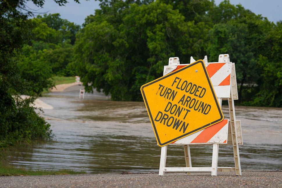
“So (in the Pacific region) you need to be aware that you may get hit with some flooding that could damage your property or businesses, and the probability is a little higher this year compared to other years,” Pastelok says.
El Nino does not eliminate the threat of a high-impact storm, according to AccuWeather experts. The El Nino weather patterns can actually bring hurricanes closer to shore, posing an increased risk and leaving little time to prepare.
What Does El Nino Mean for Weather Patterns Globally?
While most El Ninos begin in the fall, this one began during the summer season, which could alter conditions.
A summer-formed El Nino does not interact with the jet stream that is seen during winter months. So the results are different.
The jet streams that steer the world’s storm tracks move farther North in the summer, and remain out of El Ninos reach. In the past, a summer El Nino has brought heavier rains from the plains to the Appalachians and cooler temperatures in the Northeast, Pastelok says.
As the months get cooler the El Nino correlations get stronger and more apparent. The usual powerful El Nino weather, like heavy rainfall and snow seen in the West and Southeast don’t occur until the winter months.
Pastelok expects this summer’s El Nino to have bigger impacts on the tropics. If the tropics are shut down with storms, the south may start to heat up.
“We’re still concerned … that there still could be pockets of drought that does develop, and maybe even some fires that could erupt out of season in the Southeast,” Pastelok says.
There is also a 30% to 40% chance this turns into a rare “Super El Nino,” according to AccuWeather experts. A “super” El Nino is an extreme phase of the climate pattern. It occurs when ocean surface temperatures rise more than 2 degrees Celsius above average.
How Do I Prepare?
Though El Nino is in the spotlight right now, everyone should be prepared for changes in weather, no matter where you live.
It is important to stay updated on weather patterns, and check the forecast consistently. Especially if you live in a vulnerable area, like the southeastern Gulf Coast, Pastelok says.
“El Nino, and what we’re forecasting is, is not a day-to-day thing, it’s an overall event that can last for months. There could be other months where it’s not affecting you, and there could be months where it is,” Pastelok says.